Should I take 14 or 16 over the Bighorn Mountains?
Between South Dakota and Yellowstone stand the Bighorn Mountains. This imposing mountain range runs North/South for about 150-200 miles and it stands directly in your path.

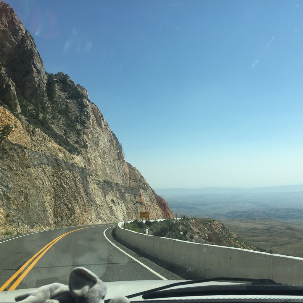
TAKE YOUR TIME. Imagine how intimadating these mountains must have been to settlors approaching them by wagon! While still intimidating today, you will find well maintained, wide laned roads, traversable by any type of vehicle. Plan some extra time and take advantage of the numerous turn-outs to rest your brakes and your nerves and don't forget to take in the incredible scenery!
NOT AT NIGHT: Do yourself a favor and plan on going over these mountains during the day. Large animals (moose, elk and deer), a lack of cell phone coverage and steep inclines make driving over the Bighorns at night unadvisable!
WHICH WAY SHOULD YOU GO? If you are a large rig, are pulling a trailer, or just prefer an easier mountain drive, we recommend the SOUTHERN ROUTE, taking you over Powder Pass on US 16 between Buffalo (HWY 90) and Ten Sleep/Worland (Hwy 14/16/20). This route is less switchy and less steep than US 14.

Recommended Route:
1. The Southern Route: US Highway 16 - Buffalo to Worland then Greybull
This route is considered the "best and safest" way over the mountains due to its gentler grades and wider curves.
- Path: Yellowstone East Entrance → Cody → Greybull → US-16/US-20 South → Worland →
US-16 East→ Ten Sleep → Buffalo → I-90 East to the Black Hills.
- NOTE: GO ALL THE WAY TO WORLAND - GPS loves to turn you off onto a farm road, from Manderson (SR WY 31) to (CTY Rd 43) at Ten Sleep saying its faster. It is not! The road is uneven and not trailer friendly.
- Highlights:
- Ten Sleep Canyon: Spectacular scenery and a premier destination for rock climbing.
- Ten Sleep Brewery: https://tensleepbrewingco.com/?age-verified=2e21df6192
- A fantastic little brewery, in a primo location. If you stop, try a local favorite, the Speed Goat (Also available in Greybull)
- Powder River Pass: The highest point on US-16, reaching an elevation of 9,666 feet.
- Meadowlark Lake: A scenic alpine lake near the crest of the mountains, ideal for fishing or a midday break.
2. The Northern Route: US Highway 14 - Sheridan to Greybull
This route is famous for dramatic elevation changes and rugged canyon views.
- Path: Yellowstone East Entrance → Cody → Greybull → US-14 East
→ Shell → Burgess Junction → Dayton → Sheridan → I-90 East to the Black Hills. - Highlights:
- Shell Canyon & Shell Falls: A steep pitch of granite where Shell Creek cascades down a spectacular waterfall.
- Granite Pass: The highest point on US-14 at approximately 9,033 feet.
- Steep Grades: This route features hairpin curves and sharp elevation gains, making it more challenging for large RVs or cautious drivers.

NOTE: DO NOT TAKE 14 A! 14 A Branches off at Burgess Junction and will take you to Lovell, WY then on to Cody, However, this is a Very Steep, Very Switchy road and should not be attempted with an RV or trailer! Come to the campground, unhook or take your tow and enjoy this beautiful road later!!
Don't forget to relax, take your time, and enjoy one of the prettiest drives in the US!