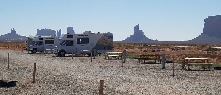
Your cart is empty!
Make checkout easy by booking all your reservations at once. Add your sites from different campgrounds into your shopping cart* and then choose checkout.
Don't be surprised if you need to extend your stay after seeing all the area has to offer. Below are some of the local activities you can enjoy while staying with us.
While visiting the Monument Valley, you will need to try the 17-mile loop drive for a view of the scenic beauty and magnificent formations. Currently, with the monsoon season we want all travelers to know that the valley drive has very rough terrain and deep sand dunes. Motorcycles/RV's are Prohibited on the loop drive.We ask that travelers be prepared for long wait times and inclement weather during the peak season. Which begins in the months of May to September, the high volume of travelers will create some wait time. So please be cognizant of your surroundings and please obey all signs, stay on designated routes; stay hydrated and stay safe. The safety of our public and community is our utmost importance. Also, wear appropriate attire as the weather is unpredictable and can change at any time. Wearing a hat, t-shirt, long sleeves and tennis shoes will keep you comfortable and avoid the elements. Including, staying hydrated and have water on you at all times which makes you less prone to heat exhaustion and dehydration.
Navajo Name: Tse'Bii'Ndzisgaii – Monument Valley.
Hiking Trails: Wildcat Trail 1.5 miles (Sign in/out at Visitor Center).
Monument Valley Hours of Operation:Park/Administration Office: 8:00 am to 5:00 pm. (Lunch 12:00 to 1:00 pm). Monday-Friday.
Winter Hours-Scenic Drive: 8:00 am to 5:00 pm, Monday – Sunday.
Last Entry at 2:30 pm, Daily.
Tour Booth: 8:00 am to 6:00 pm, Monday – Sunday.
Summer Hours-Scenic Drive: 7:00 am to 7:00 pm, Monday – Sunday.
Last Entry: 4:30 pm, Daily.
Tour Operator Booth: 8:00 am to 5:00 pm, Monday – Sunday.
Monument Valley Closures: We are Closed during all major Holidays in accordance with the Navajo Nation.
Monument Valley is not only one of the most photographed places on Earth, but also has been the the backdrop for many Hollywood films. Stop at Forrest Gump Point on Hwy 163 between Monument Valley and Mexican Hat where Forrest ended his cross-country run in the movie. Please use extreme caution while taking photos along the side of the highway.
Valley of the Gods is a scenic backcountry area is southeastern Utah, near Mexican Hat. It is a hidden gem with scenery similar to that of nearby Monument Valley. Valley of the Gods offers isolated buttes, towering pinnacles and wide open spaces that seem to go on forever. Valley of the Gods offers similar scenery without the tribal restrictions; it is located on BLM land and is open for hiking, backpacking and camping. There are no designated trails or campgrounds, but there is plenty of backcountry where you can wander and explore.
A 17-mile dirt and gravel road winds through the valley. It is sandy and bumpy, with steep sections. It provides a fun drive through an area that is usually deserted. It is a great place to get away from civilization - to get away from everything associated with modern life.Bike enthusiasts enjoy riding the road through the valley.Because of its isolated nature, people exploring Valley of the Gods need to be self-sufficient and carry emergency supplies. There are no facilities, no gas stations, stores or services. You may or may not see other travelers along the road.
The Valley of the Gods Road runs between Highways 163 and 261. The road forks away from Hwy 163 about 7.5 miles north of Mexican Hat. It winds north and west and then connects with Hwy 261 about 6.5 miles northwest of the point where Hwy 261 forks from Hwy 161. The road is recommended for high clearance vehicles. During dry weather, many people drive the road in family cars - but be advised that it can be rough. When the weather is wet a 4X4 may be needed to get through. The western end of the Valley of the Gods road connects with Hwy 261 just below what is known as the Moki Dugway. The Moki Dugway is section of very tight switchbacks that allow Hwy 261 to climb the cliff face to the top of Cedar Mesa.
From US Hwy 163, turn off on State Hwy 261 to take the dirt switchbacks of the Moki Dugway to Muley Point. The views are gorgeous, but make sure your vehicle and your nerves can handle the drive before you go. The switchbacks are tight, not recommended for trailers, and there are no railings.
While still a part of Glen Canyon National Recreation Area, Muley Point has a unique perspective on the far corner of the San Juan Arm. Here you can enjoy unrivaled views of Monument Valley, Navajo Mountain, and the deeply entrenched canyons of the San Juan River. To ensure that Muley Point remains a special place for your future visits and future generations please follow all regulations and plan accordingly. Thorough trip planning is not only your first step in having a safe and enjoyable trip, but also in protecting the natural and cultural resources in the area.
On the edge of a deep canyon above the sinuous river meander known as a gooseneck, this small park affords impressive views of one of the most striking examples of an entrenched river meander on the North American continent. The San Juan River twists and turns through the meander, flowing a distance of over six miles while advancing one and a half miles west on its way to Lake Powell. Gaze at the results of 300 million years of geological activity, where the San Juan River winds and carves its way through the desert 1,000 feet below.
Park fees:
$5.00 day-use fee per car with up to 8 people.
$2.00 day-use fee per vehicle for seniors (65+)
$2.00 per person fee for bus tour groups.
If no ranger is on duty, pay at the fee tube using the self serve envelopes.
This curiously named town draws its moniker from a rock formation that, from some angles, resembles a sombrero, or a "Mexican Hat." The formation is about two and a half miles northeast of town. Mexican Hat is on Hwy 163, 20 miles southwest of Bluff where a bridge passes over the San Juan River.
The settlement was founded by E.L. Goodridge who established an unproductive oil claim there in 1908. These days what is on the surface is of more interest than what might lie below. Mexican Hat is the take-out point for daily San Juan River trips. Friday and Saturday evenings in the summer, musicians often play at the Mexican Hat Lodge.
Sand Island is located on the north bank of the San Juan River about 3 miles west of Bluff, Utah, on the south side of Highway 191. The Sand Island panel is an impressive rock wall that stretches more than 100 yards, and is covered with ancient Anasazi scrawlings estimated to be anywhere from 800 to 2,500 years old. When you study the panel up close you'll find images that span nearly the whole time humans were known to inhabit the Four Corners Anasazi markings from the early Basketmaker period through the Pueblo III period, and, more recently, records from Ute and Navajo people. Etched onto the rock are geometric patterns and shapes, human figures, several types of animals and numerous Kokopellis the icons of rock art. Based on the sheer number and variety of petroglyphs, experts believe this panel held special significance among ancient people.
GPS Coordinates: 37.25, -109.56
The original Bluff Fort has been rebuilt and lovingly restored through the efforts of the Hole in the Rock Foundation (www.HIRF.org) and is open to visitors free of charge. You can learn more about why the pioneers came to Bluff and their arduous journey over the Hole in the rock trail. One of the original cabins, the Barton Cabin, may still be seen at the Bluff Fort. You will also find one of the original wagons used in the Hole in the rock expedition. Replicas of the original log cabins and the Meetinghouse have been constructed to give the visitor a glimpse of pioneer life on the San Juan in the 1880's. A replica of the Co-op Store was completed in 2013 and serves as the Visitors Center and Gift Shop.
Admission is free.
Three majestic natural bridges invite you to ponder the power of water in a landscape usually defined by its absence. View them from an overlook, or hit the trails and experience their grandeur from below. Declared a National Monument in 1908, the bridges are named "Kachina," "Owachomo" and "Sipapu" in honor of the Ancestral Puebloans who once made this place their home.
Natural Bridges National Monument is a U.S. National Monument located about 50 miles northwest of the Four Corners boundary of southeast Utah, in the western United States, at the junction of White Canyon and Armstrong Canyon, part of the Colorado River drainage.
As you travel to the Four Corners Monument this is the only place in the United States where four states intersect at one point. Arizona, New Mexico, Utah and Colorado. The original marker was erected in 1912 which was a simple cement pad, but since then has been redone with granite and brass. Which what you see today, and the monument has grown since. We invite you to visit the Navajo Vendors that sell handmade jewelry and traditional Navajo Foods nearby. There is also a Trading Post about 30 miles from the monument, that sells groceries and gas.
Hours of Operation:
Winter Hours: October 1
Main Office: 8:00 am to 5:00 pm. Monday- Sunday
Vendors: 8:00 am to 5:00 pm Monday – Sunday
Phone: (435) 727-5870 (temporary message line).
Closed on all Major Holidays:
New Year's Day, Thanksgiving Day, NN Family Day (day after thanksgiving), Christmas and all other Navajo Nation Holidays.
Bears Ears National Monument, co-managed by the Bureau of Land Management Monticello Field Office, the Manti La Sal National Forest, and the five Tribes of the Bears Ears Commission, is an outstanding landscape with extensive cultural and natural resources. Every year, visitors to Bears Ears National Monument enjoy many recreation activities, including hiking, backpacking, rock climbing, river rafting, and riding off highway vehicles. However you choose to enjoy your visit to this area, remember to visit with respect, leave no trace, and know before you go. There are three main Bureau of Land Management areas where you may consider recreating within Bears Ears National Monument.
That doesn't mean this area has to always be empty. When you start reviewing camping options, your history will display here to help compare sites and find the best stay. You will be able to share your stay information with friends or family and save it for a later time if you have a KOA Account.
Make checkout easy by booking all your reservations at once. Add your sites from different campgrounds into your shopping cart* and then choose checkout.