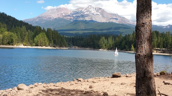
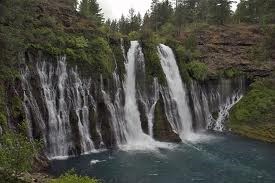
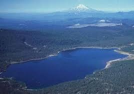
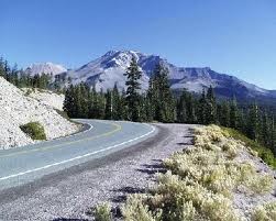
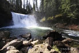
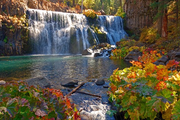
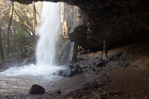
Local Area Attractions Near Mount Shasta City KOA Holiday

Mt Shasta City / Siskiyou County where the population numbers are small but the activities and places to see, visit and explore, outnumber the people. Starting at the top is Mt. Shasta, coming from any direction the volcano is visible from hundreds of miles away. Our KOA rests at the bottom and only minutes from the trailheads where people from all over the world come to gather. From glistening lakes and world-class rivers to scenic drives and backcountry roads, the area provides something for everyone to discover and enjoy. Use Mt. Shasta as your base camp while you visit and explore the area.

Box Canyon Dam and Trail

Box Canyon Dam and Trail

This dam impounds the Sacramento River to form Lake Siskiyou near Mount Shasta. Completed in 1965, the 209-foot-high dam provides flood control and hydroelectric power for the region. The Box Canyon Trail is an easy, out-and-back path that parallels the rugged Sacramento River gorge just below the dam.

  • Length: Approximately 1.3 to 1.5 miles round-trip.
  • Difficulty: Easy and family-friendly with minimal elevation gain.
  • Highlights:
  • [list]
  • Scenic Vistas: Multiple viewpoints look down into the steep, rocky canyon.
  • The "Graveyard": A unique feature where old car bodies and appliances from the 1930s—remnants of an old dump site—are visible along the trail.
  • Inner Gorge Spur: A more challenging spur trail uses ropes and iron ladders to allow hikers to descend to the canyon floor. 

  • Access: The trail head is located off W.A. Barr Road, about 1.5 miles from the central Mt. Shasta I-5 exit.
  • Parking: Limited parking is available on the gravel shoulder near the dam or at the paved Lake Siskiyou parking area across the street.
  • Cost: Admission to the dam and trail area is free.
  • Best Time to Visit: The trail is generally accessible year-round due to its lower elevation, though it is most popular from April through October.
  • [/list]

    Shasta-Trinity National FOrest

    Triity Mountains

    Mt Shasta, CA 96067

    Castle Crags State Park

    Castle Crags State Park

    Castle Crags State Park
     is famous for its dramatic 6,000-foot-tall granite spires that rise sharply from the surrounding forest. Located just south of Dunsmuir, this park offers a mix of intense alpine hiking and relaxing riverside activities. With 28 miles of trails, the park caters to both casual sightseers and strenuous climbers.

    • Vista Point Overlook: An easy, 0.5-mile accessible trail. It provides a stunning panoramic view of the Castle Crags and Mount Shasta with minimal effort.
    • Crags Trail to Castle Dome: The park's most popular strenuous hike. This 5.5-mile round-trip trail climbs steeply through forest and over granite rock, ending at the base of Castle Dome.
    • Root Creek Trail: A gentle, 3.2-mile shaded path that follows a year-round flowing creek to a seasonal waterfall.
    • Sacramento River: The river flows through the park's lower levels, offering spots for swimming and fishing. A notable pedestrian suspension bridge crosses the river at the Riverside area.
    • Pacific Crest Trail (PCT): A segment of this legendary trail winds through the park, often used as a rest stop for long-distance hikers.

    • Access: Located at Exit 724 on I-5, about 6 miles south of Dunsmuir and 48 miles north of Redding.
    • Cost: The vehicle day-use fee is $8.00.
    • Camping: The park has 76 developed campsites with fire rings and picnic tables.
    • [list]
    • Reservations: Can be made through ReserveCalifornia.
    • Note: Some sites are near the highway/railroad and may experience noise from trains and traffic.

  • Rules: Dogs are not allowed on hiking trails, though they are permitted in developed areas like campgrounds and paved roads.
  • Best Time to Visit: Summer and fall are best for high-elevation hiking. Spring is ideal for seeing Burstarse Falls and wildflowers, while winter may see occasional road closures due to snow
  • [/list]

    Website

    Dogsledding

    Dogsledding

    Dogsled Express offers a unique and exhilarating winter adventure in the shadow of Mount Shasta, allowing tourists to experience the "Old West" method of travel through guided sled dog tours.
    The Experience
    Visitors are pulled across pristine, snowy trails by a team of enthusiastic and well-trained Alaskan huskies. The tours are designed to be personal and educational: 

    • Meet the Team: One of the highlights is meeting and petting each dog on the tour team before heading out.
    • Majestic Scenery: The trails wind through the Shasta-Trinity National Forest, offering spectacular views of Mount ShastaMt. Eddy, and Castle Crags.
    • Guided Insight: Tours are led by experienced mushers—like owner Pat—who share stories about the sport, the dogs' personalities, and the local history.

    Visitor Logistics
    • Location: Tours typically stage south of Mt. Shasta near the Mt. Shasta Ski Park and Mt. Shasta Nordic Center. To get there, take the McCloud exit east from I-5 onto Hwy 89, then travel approximately 6 miles to Ski Park Rd.
    • Season: Tours generally run from opening day (December) through February, depending on snow conditions.
    • Capacity & Pricing:
    • [list]
    • Adults: ~$95.
    • Children: ~$55 (recommended for preschoolers and older).
    • Sled Loads: Sleds are typically assigned 1 adult and 1 child; check with the operator for larger groups or dual-adult sleds.

  • Contact: Reservations are highly recommended. You can contact them at 530-467-3009 
  • [/list]
    Pro Tips for Travelers
    • Dress Warmly: You will be sitting close to the snow for 20–60 minutes. Wear waterproof boots, thermal layers, and a heavy coat.
    • Off-Season: During spring and fall, the company often offers cart rides (wheeled sleds) when snow isn't present.
    • Photo Ops: Arrive a few minutes early to watch the dogs being harnessed—this is often the best time for photos and seeing the dogs' excitement.

    Ski Park Hwy/ County Rd 31

    Mt. Shasta, CA 96067

    530-467-3009

    Website

    Dunsmuir Botanical Gardens

    Dunsmuir Botanical Gardens

    A tranquil, 10-acre riverside retreat nestled within Dunsmuir City Park, right along the headwaters of the Upper Sacramento River. It is highly regarded as one of the best stops for travelers on the I-5 corridor. 

    • Diverse Flora: The hilly, wooded grounds feature native species like Shasta lilies, fragrant azaleas, and prolific white dogwood that blooms beautifully in the spring. You'll also find introduced varieties such as Japanese maples and rhododendrons.
    • Riverside Trails: Numerous walking paths meander through the park, including a scenic riparian trail that follows the rushing Sacramento River.
    • Unique History: Visitors enter the park at a historic 1901 Baldwin steam locomotive. The adjacent baseball stadium is famous as the site where Babe Ruth once played an exhibition game.
    • Family-Friendly Amenities: The park is free to the public and includes a playground, clean restrooms, and multiple picnic sites with barbecue grills.
    • Events: The large meadow serves as a quiet retreat but also hosts social gatherings and the annual "Tribute to the Trees" outdoor concert in the summer
    • Access: Turn off the main road at the "Black Train Engine" near the Community Building. Follow the road uphill and around the tennis courts to find the parking lot by the river.
    • Leashed Pets: Dogs are welcome as long as they remain on a leash.
    • Fly Fishing: The river access is popular with anglers fishing for wild rainbow trout.

    4841 Dunsmuir Avenue

    Dunsmuir, CA 96025

    530-235-4740

    Website

    Dunsmuir Railroad Museum / Amtrak Depot

    Dunsmuir Railroad Museum / Amtrak Depot

    Managed by the Dunsmuir Railroad Depot Historical Society, is a central hub for rail history located in the historic Dunsmuir Amtrak Depot. It houses an extensive collection of artifacts, photographs, and archives that detail Dunsmuir's origins as a vital railway stop. 

    • Operating Hours: The museum is typically open every 2nd Saturday of the month from 1:00 PM to 4:00 PM (May through October).
    • Admission: Entry is generally free, though donations to support the historical society are encouraged.
    • Special Events: The museum often expands its hours during major town events, most notably the annual Dunsmuir Railroad Days held in June
    • Siskiyou Division Archives: Since 2012, the museum has been the official home of the Southern Pacific (SP) Shasta Division archives.
    • Railroad Display Room: Opened in 2006, this room features "Photo Walk" locomotive photographs, equipment, and memorabilia.
    • Local History Exhibits: Beyond trains, you can find displays on early Native American settlers, including the Elinore Van Fossen Harrison Basket Collection, and the town's history as a world-class fly-fishing destination.
    • Rail Cam: For those who can't visit in person, the society maintains a live-streaming Rail Cam on their YouTube channel to watch trains pass through the canyon in real-time.

    5750 Sacramento Avenue

    Dunsmuir, CA 96025

    530-235-0929

    Website

    Golf Courses

    Golf Courses

    Siskiyou County is home to several scenic golf courses, most of which offer dramatic views of Mount Shasta. Here are the primary courses in the county:
    18-Hole & Resort Courses

    • Mount Shasta Resort (Mt. Shasta City): A premier 18-hole, par-70 course set at 3,500 feet. It features a professional pro shop, a restaurant, and overnight chalets on Lake Siskiyou.
    • Lake Shastina Golf Resort (Weed): This resort features 27 holes designed by Robert Trent Jones Sr. The 18-hole championship course is famously nicknamed the "Magnificent Monster."
    • Eagle's Nest Golf Course (Klamath River): Located near the Oregon border, this course is highly regarded for the quality of its greens and its scenic river setting.

    9-Hole & Historic Courses
    • McCloud Golf Club (McCloud): Established in 1923, this is one of California's oldest courses. It offers a classic 9-hole layout with wide fairways and historic charm.
    • Weed Golf Club (Weed): A casual, 9-hole public course built in the 1920s. It's known for being affordable and having some of the best mountain views in the region.
    • Shasta Valley Golf Course (Montague): A 9-hole course located in the valley east of Yreka, offering a more open, high-desert playing experience.

    Disc Golf
    • Greenhorn Park (Yreka): While not a traditional ball-golf course, this is a top-rated 18-hole disc golf course featuring technical holes and beautiful vistas.

    Shasta Caverns

    Shasta Caverns

    Lake Shasta Caverns National Natural Landmark is a premier "three adventures in one" experience located approximately 17 miles north of Redding. This geologic wonder features ancient limestone formations and is uniquely accessible only by water. 
    The "Three-Part" Adventure A standard tour lasts approximately two hours and follows a specific sequence: 

    1. Catamaran Cruise: A 10-minute boat ride across the McCloud Arm of Shasta Lake.
    2. Scenic Bus Ride: A shuttle climb 800 feet up the mountain, offering panoramic lake views.
    3. Guided Cave Tour: A 45- to 60-minute walk through spectacular rooms like the vast Cathedral Room, filled with stalactites, stalagmites, and rare helictites.

    Essential Visitor Tips
    • Physical Requirements: The tour is moderately strenuous, involving over 600 stairs. It is not wheelchair accessible, and strollers are prohibited.
    • Climate: The caverns maintain a constant 58°F temperature year-round with high humidity, making it feel like 68–72°F; a light sweatshirt is recommended.
    • Check-In: Arrive at least 30 minutes early to secure your spot; the boat departs strictly on time.
    • Family Fun: Beyond the tour, kids can enjoy the "Rock Box" playground or the Sandy Creek Mining Sluice to search for gemstones.

    20359 Shasta Caverns Road

    Lakehead, CA 96051

    530-962-5073

    Website

    Lake Siskiyou

    Lake Siskiyou

    A premier day-use destination with clear water, sandy beaches, and direct views of Mount Shasta. You do not need to be a camper to access the resort's amenities or the public trails surrounding the lake. 

    • Entrance Fee: Typically $3 per person (ages 11+) for a day pass, payable at the front gate.
    • Hours: Day-use visitors are generally allowed from 8:00 AM to 10:00 PM.
    • Beach Area: Features a sandy shore, a roped-off swimming area, and grassy picnic spots with tables.
    • Waterpark (Splash Zone): An inflatable obstacle course on the lake, open seasonally (usually Memorial Day to Labor Day). Costs are approximately $8 per hour or $15 for four hours.
    • Rentals:
    • [list]
    • Beach Rentals: Kayaks (single and tandem) and stand-up paddleboards (SUPs) are available right on the sand for about $15–$20 per hour.
    • Marina Rentals: You can rent patio boats, fishing boats, and even "party barges" for larger groups at the resort marina.

  • Lake Siskiyou Trail: A 7-mile loop trail that is free to access from multiple trailheads outside the resort (e.g., at Box Canyon Dam or Cable Beach). It is mostly flat and offers the best photography spots for Mount Shasta's reflection.
  • Dining: The Lake Sis Grille & Brew is open to the public for breakfast, lunch, and dinner, and there is an ice cream shop and snack shack near the beach.
  • Parking: Day-use parking fills up very fast on summer weekends; arriving before 10:00 AM is highly recommended.
  • Pet Policy: Dogs are not allowed on the resort beach or in the picnic areas. However, they are welcome on the 7-mile loop trail as long as they are on a leash.
  • Off-Season: The resort facilities are seasonal, but the lake and trail remain open year-round for hiking and fishing.
  • [/list]

    Lava Beds National Monument

    Lava Beds National Monument

    Lava Beds National Monument
     is a vast, volcanic landscape in northeastern California, often called the "Land of Burnt-Out Fires." It is situated on the flank of the Medicine Lake shield volcano and preserves a massive concentration of lava tube caves and historic battlefields. The park is divided into unique subterranean and surface features, catering to both casual visitors and experienced explorers.

    • Lava Tube Caves: Home to over 800 caves, with about two dozen developed for public access.
    • [list]
    • Mushpot Cave: The only lit cave in the park, featuring interpretive signs and smooth floors for an easy introduction.
    • Skull Cave: A massive, multi-level tube known for its year-round ice floor and historic bone discoveries.
    • Valentine Cave: Features large, open chambers and unique lava "bench" formations.

  • Cultural & Historic Sites:
    • Captain Jack's Stronghold: A natural lava fortress used by the Modoc Indians during the Modoc War of 1872–73.
    • Petroglyph Point: One of the largest panels of Native American rock art in the United States.

  • Surface Trails:
    • Schonchin Butte: A 0.7-mile (one-way) trail climbing 500 feet to a historic fire lookout with panoramic views of the volcano and Tule Lake Basin.

  • Access: Located near Tulelake, CA, about 10 miles south of the Oregon border. The main entrance is reached via CA-139 or Hwy 161.
  • Permits & Gear: A free caving permit is mandatory for anyone entering caves, available at the Lava Beds Visitor Center.
    • Gear: You will need at least two light sources per person, sturdy footwear, and optional helmets/knee pads (which can be rented or borrowed at the visitor center).

  • Cost: Standard entrance is $25 per vehicle (valid for 7 days); National Park passes are accepted.
  • Camping: Indian Well Campground offers 43 first-come, first-served sites for $20 per night near the visitor center.
  • Best Time to Visit: Open year-round, but late spring and early fall offer the most comfortable surface temperatures. Caves remain roughly 55°F year-round.
  • [/list]

    1 Indian Well

    Tulelake, CA 96134

    530-667-8113

    Website

    McArthur - Burney Falls Memorial State Park

    McArthur - Burney Falls Memorial State Park

    McArthur-Burney Falls Memorial State Park is home to the 129-foot Burney Falls, famously called the "Eighth Wonder of the World" by Teddy Roosevelt. It is a massive 100-million-gallon-per-day cascade where water gushes both from the top and directly through the porous volcanic rock face.

    • Fees: Day-use parking is $10 per vehicle. Senior discounts ($2 off) are available for drivers aged 62+.
    • Best Time to Visit: To avoid heavy crowds and traffic delays on Hwy 89, visit on weekdays or early mornings. Late afternoon (after 4:00 PM) is also a good time to arrive if the park was full earlier in the day.
    • Hiking: The 1.2-mile Falls Loop Trail is the most popular route, taking you from the main overlook down to the mist-filled basin and back up via two scenic bridges.
    • Dogs: Pets are allowed in the campground and day-use parking areas but are strictly prohibited on the trails leading to the base of the falls.

    Hwy 89

    Burney, CA 96013

    530-335-2777

    Website

    McCloud Mercantile Company

    McCloud Mercantile Company

    The McCloud River Mercantile Company is a shopper's paradise offering a variety of general merchandise, vintage lines, apparel, apothecary, gourmet foods, fine wines, and ales. Guests have commented that “the Mercantile is a fun place to be during a winter storm because you can keep in touch with folks in the stores and cafes or find a quiet place to read a good book all under one roof.”

    241 Main Street

    McCloud, CA 96057

    530-964-2330

    Website

    McCloud Outdoors & Gear Exchange

    McCloud Outdoors & Gear Exchange

    Full service outdoor store that offers rental equipment as well as sales.

    209 Quincy Ave

    McCloud, CA 96057

    530-316-4327

    Website

    Medicine Lake

    Medicine Lake

    Medicine Lake is not just a scenic destination; it is a profound geological and spiritual landmark with a history that spans thousands of years.
    1. Spiritual Significance (The Cradle of Life)
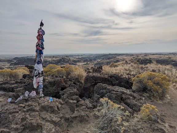
    For the Modoc, Pit River, Shasta, Karuk, and Wintu tribes, Medicine Lake is a sacred site used for healing, prayer, and vision quests.

    • The Name: The lake earned its name because Native Americans believed the water and the surrounding obsidian had powerful medicinal properties.
    • Sáttítla Highlands: In 2025, the area was designated as the Sáttítla National Monument specifically to protect this cultural heritage. For many tribes, the lake is considered the "Cradle of Life," and traditional ceremonies are still held here today.

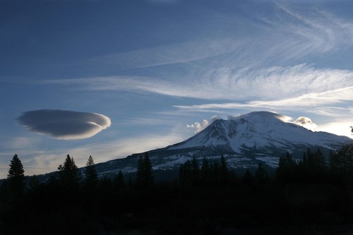
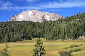
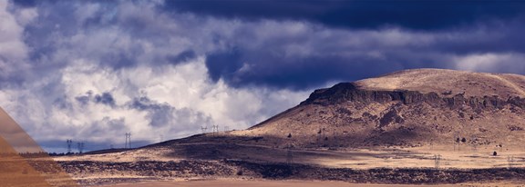
    2. Volcanic History (The Shield Volcano)
    Medicine Lake sits in the center of the largest volcano by volume in the Cascade Range.
    • A "Shield" Giant: Unlike the steep, conical Mt. Shasta, Medicine Lake is a "shield volcano," meaning it is broad and flat. Its caldera—the massive crater formed after a collapse—is where the lake now sits.
    • The Glass Flows: About 1,000 years ago (a blink of an eye in geological time), massive eruptions created Glass Mountain. This resulted in 15 cubic miles of obsidian—one of the largest glass flows in the world.
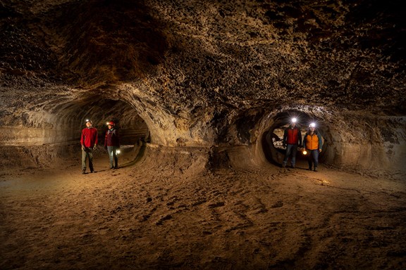
    3. The Obsidian Trade
    Historically, this region was the "factory" of the ancient West.
    • Weaponry & Tools: The high-quality obsidian from the Medicine Lake Highlands was prized for making arrowheads and cutting tools.
    • Ancient Commerce: Archaeologists have found Medicine Lake obsidian as far away as the Great Plains and Canada, proving that a massive trade network existed long before European arrival.

    4. Modern Preservation
    The history of the lake in the 20th century was marked by a long-standing battle over geothermal energy. For decades, tribes and conservationists fought to prevent industrial drilling in the caldera. This struggle culminated in the 2025 National Monument status, ensuring the "quiet history" of the lake remains undisturbed.
    Tourist Note: Respecting History
    When visiting, you are standing on a site of active worship. Visitors are asked to leave no trace and, most importantly, never remove obsidian. Taking "souvenirs" is seen as a desecration of the sacred site and is also a federal offense.

    Website

    Mt Shasta Brewing Company a "Siskiyou County favorite"

    Mt Shasta Brewing Company a "Siskiyou County favorite"

    Mt. Shasta Brewing Company is a microbrewery based in Weed, California, the makers of Weed Ales & Lagers. Owners Vaune and Barbara Dillmann began commercial production in 2003. Mount Shasta Brewing Company is licensed to distribute its beers in the states of California, Oregon, and Washington. The brewery has won awards for its beers, for local community involvement and for its marketing success with the slogan "Try Legal Weed"

    360 College Avenue

    Weed, CA 96094

    530-938-2394

    Website

    Mt. Shasta the Volcano

    Mt. Shasta the Volcano

    Mt Shasta is the second highest peak in the Cascade Range, surpassed only by Mount Rainier which is just 249 feet taller. The mountain is one of the southernmost volcanoes in the Cascades, with only Lassen Peak further south Shastina, The last eruption occurred in 1786; the sulfur springs near the top of Mount Shasta give warning that the mountain will reawaken in the future.

    Mt Shasta Chamber of Commerce and Visitors Center

    Mt Shasta Chamber of Commerce and Visitors Center

    The Mount Shasta Chamber of Commerce is a non-profit organization dedicated to developing and promoting trade and tourism in the Mount Shasta area for the benefit of our members and the citizens of our community. The Chamber is located at the NE Corner of Lake Street at Pine, walking distance from the KOA.

    300 Pine Street

    Mt Shasta, CA 96067

    530-926-4865

    Website

    Mt Shasta City Park / Sacramento River Headwaters

    Mt Shasta City Park / Sacramento River Headwaters

    Originally the summer campus of the Chico State University, it was turned over to the city when air conditioning made summer classes in Chico practical. A spring in the park is the primary source of the Sacramento River. Contains senior Center and other buildings used by various clubs and organizations. There is a large play field, playground equipment, picnic tables, BBQ's and restrooms. Located just North of the Mt Shasta KOA off North Mt Shasta Blvd.

    Mount Shasta Fish Hatchery

    Mount Shasta Fish Hatchery

    Mount Shasta Fish Hatchery is the oldest operating hatchery in the West. Large open ponds hold Rainbow and Brown trout. Only minutes from the Mt Shasta City KOA.

    3 North Old Stage Road

    Mt Shasta, CA 96067

    530-926-2215

    Website

    Mount Shasta Scenic Drive

    Mount Shasta Scenic Drive

    Northern California is famous for its "All-American Roads" and historic mountain passes. Since you're often in the Mt Shasta KOA area, you're perfectly positioned to explore some of the most dramatic terrain in the state.

    1. The Volcanic Legacy Scenic Byway This is the "crown jewel" of northern drives, a 500-mile journey that connects several volcanoes, including Lassen PeakMedicine LakeMt. Shasta, and Crater Lake in Oregon.

    • The Best Stretch: From Mt. Shasta City, head north on Highway 97. This route provides iconic, panoramic views of the mountain reflecting in your rearview mirror as you descend into the high desert.
    • Must-See Stop: The Living Memorial Sculpture Garden along Hwy 97, where massive metal sculptures stand in the shadow of the mountain.

    2. The Trinity Scenic Byway (Highway 299) Known as the drive "From the Valley Oaks to the Redwood Coast," this route follows the old trails of Gold Rush miners. 
    • The Route: Starts in Redding and winds west past Old Shasta State Historic Park and Whiskeytown Lake, then climbs over Buckhorn Summit into the lush Trinity River Gorge.
    • Highlights: The historic mining town of Weaverville is a perfect halfway point for lunch and a walk through its preserved brick-and-iron storefronts

    3. The Bigfoot Scenic Byway (Highway 96) If you want to get truly off the beaten path, this route follows the Klamath River through what is legendary as "Bigfoot country".
    • The Drive: From I-5 near Yreka, head west on Hwy 96. The road clings to the cliffs above the emerald-green river, passing through tribal lands and remote hamlets like Happy Camp.
    • Why It's Special: It offers some of the most rugged and unpopulated river canyon scenery in California, perfect for those seeking solitude and raw nature

    US Forest Service

    412 West Alma Street

    Mt Shasta, CA 96067

    530-926-4511

    Website

    Mt. Shasta Sisson Museum

    Mt. Shasta Sisson Museum

    Only 1/2 mile off I-5.
    Shares the property with the oldest fish hatchery west of the Mississippi River
    Fun and educational for the whole family
    Many interesting exhibits

    1 North Old Stage Road

    Mt Shasta, CA 96067

    530-926-5508

    Website

    Mt. Shasta Ski Park

    Mt. Shasta Ski Park

    Nestled at 5,500ft is Mt. Shasta Ski Park. Located in northern California,  on HWY 89 between the City of Mount Shasta and the town of McCloud, Mt. Shasta Ski Park offers fun for everyone! Come enjoy the snow during winter operations with a family fun ski environment. Also offering backcountry skiing and terrain for all levels! Summer operations include downhill lift access mountain biking, scenic chairlift rides, our Black Diamond Bar & Grill, weddings, disc golf, and more! Embrace your inner mountain and visit skipark.com for more information.

    Ski Park Hwy

    McCloud, CA 96067

    530-926-8610

    Website

    River Dancer's Rafting & Kayaking

    River Dancer's Rafting & Kayaking

    Whether you are looking for a half-day Klamath River outing for little ones through grandparents, or a multi-day family rafting adventure in the Klamath River or the Trinity River, that your teenagers will be talking about for years, we're ready to help you customize an epic family river rafting vacation.

    302 Terry Lynn Avenue

    Mt Shasta, CA 96067

    530-926-3517

    Website

    Shasta - Trinity National Forest

    Shasta - Trinity National Forest

    The Shasta-Trinity is the largest national forest in California with a diverse landscape ranging from 1,000 to 14,162 feet. The 2.1 million acre forest encompasses five wilderness areas, hundreds of mountain lakes and 6,278 miles of streams and rivers. Hikers, backpackers and horseback riders will find over 460 miles of trails to explore. They range from wide trails with easy grades to rough rocky steep grades..

    US Forest Service

    412 West Alma Street

    Mt Shasta, CA 96067

    530-926-4511

    Website

    Shastice Park

    Shastice Park

    Shastice Park, at the north eastern part of the city. Shastice Park consists of 38 acres, 14 of which are developed. The barbecues, picnic tables and playgrounds make it a wonderful spot for a family outing. You can reserve a group picnic area by calling the parks department. Tennis courts, lighted soft ball field, playground, multi-use field and walking trails (undeveloped) make for a wonderful area for friends and family. The outdoor Siskiyou Ice Rink, available from November through February, is the pride of the entire south county.

    Shopping- downtown Mt. Shasta

    Shopping- downtown Mt. Shasta

    Avid shoppers in Mt Shasta can choose from an assortment of specialty stores, quaint boutiques, gift shops, and old fashioned market. Mt Shasta maintains a reputation as the South County's shopping center. The downtown area offers retail shops, coffee houses, restaurants, unique bookstores, and art galleries. Several restaurants offer outdoor seating and a view of magnificent Mt Shasta. Mt Shasta City KOA is only a short 3 blocks from the center of the shopping district.

    Siskiyou County Museum

    Siskiyou County Museum

    The Siskiyou County Museum is a county facility and together with the assistance of the Siskiyou County Historical Society has generated a wonderful collection of artifacts, photographs, and ephemera. The outstanding Siskiyou County Museum was built in 1950 by the county to collect, preserve, disseminate, and interpret the history of the area for future generations. The Siskiyou County Museum is located in Yreka approximately 40 miles north of the Mt Shasta City KOA.

    910 South Main Street

    Yreka, CA 96097

    530-842-3836

    Snowman's Hill - McCloud

    Snowman's Hill - McCloud

    A designated sledding hill at the Snowman's Hill Pass on CA Highway 89 between Interstate 5 and McCloud, California. Snowman's Hill was famous for its ski jumping, but today it is known for its sledding and tobogganing.
    Only minutes from the KOA.

    Stewart Mineral Springs

    Stewart Mineral Springs

    Sequestered in the Mt. Shasta foothills, Stewart Mineral Springs offers a unique environment of sacred mineral waters, affordable accommodations, and a variety of workshops and retreats. The indigenous Karuk Tribe has respected these springs for generations, and we've honored their devotion for 130 years. Our commitment to every guest reflects these values. Stewart Mineral Springs provides guests a holistic experience. Our retreat offers soothing private mineral baths, a wood-burning sauna and cool river plunges..

    4617 Stewart Springs Rd

    Weed, CA 96094

    530-938-2222

    Website

    Turtle Bay Exploration Park  / Sundial Bridge

    Turtle Bay Exploration Park / Sundial Bridge

    Turtle Bay Exploration Park, located in Redding is a museum complex that interprets the relationship between humans and nature. The attractions include a botanical garden, a natural history and science museum, a camp for nature, history and science education programs, and seasonal animal programs.
    Turtle Bay is approximately 1 hr south of the Mt Shasta City KOA.

    844 Sundial Bridge Drive

    Redding, CA 96601

    530-243-8850

    Website

    Lassen National Forest

    Lassen National Forest

    The Lassen National Forest lies at the heart at one of the most fascinating areas of California, called the crossroads. Here the granite of the Sierra Nevada, the lava of the Cascades and the Modoc Plateau, and the sagebrush of the Great Basin meet and blend.

    Highways 44 / 89

    Old Station, CA 96071

    530-335-7517

    Website

    Living Memorial and Sculpture Gardens

    Living Memorial and Sculpture Gardens

    The Living Memorial Sculpture Garden, created by Vietnam veteran and sculpture artist, Dennis Smith is dedicated as a war memorial. The metal sculptures evoke a powerful sense of striving for peace. Fifty-eight thousand pines, a living memorial to the 58,000 American dead in Vietnam, also grace the site. Although it is dedicated to veterans of all conflicts, the site has been developed as a “park for everyone”.Sitting areas are provided for quiet meditation and contemplation.

    Hwy 97

    Weed, CA 96094

    530-938-2218

    Website

    McCloud Falls & Trail

    McCloud Falls & Trail

    This is a  stunning series of three distinct waterfalls—Lower, Middle, and Upper—on the spring-fed McCloud River. Located just east of the town of McCloud, it is one of Northern California's most popular recreational destinations for its year-round flows and accessible viewpoints. Each tier offers a unique experience, and visitors can choose to hike between them or drive to individual parking lots at each level. 

    • Lower Falls (15 ft): A small but wide cascade that spills into a popular deep swimming hole. It features a large rocky shelf perfect for sunbathing and is the most family-friendly and accessible for swimming.
    • Middle Falls (50 ft tall, 100 ft wide): The true showstopper and most photographed of the three. A wide curtain of water drops over a basalt cliff into a massive pool. A well-maintained trail leads from an overlook down to its base.
    • Upper Falls (25 ft): The river here is forced through a narrow rock canyon, creating a powerful and dramatic surge of water into a deep basin. This tier is best enjoyed from the established overlooks, as there is no safe or sanctioned trail to the water's edge

    The trail connecting all three falls is a scenic, relatively easy route that follows the canyon rim and riverbanks.
    • Length: Approximately 3.5 to 4 miles round-trip.
    • Difficulty: Easy to moderate. The section between Lower Falls and Fowler Campground is paved and ADA-accessible.
    • Elevation Gain: Roughly 340 to 500 feet, with most of the climbing occurring on switchbacks between Middle and Upper Falls.
    • Access: Located about 6 miles east of McCloud off Highway 89. Turn onto Fowler Public Camp Road to reach the trailhead.
    • Cost: There is no entrance or parking fee. While generally free, donations are often encouraged to help the U.S. Forest Service maintain the area.
    • Facilities: Each waterfall has its own parking area, vault toilets, and picnic tables. Fowler Campground is located near the Lower Falls for those looking to stay overnight.
    • Best Time to Visit: April through October offers the best hiking and swimming conditions. In winter, the access road may be gated, requiring a walk from Highway 89.

    Upper Fall Road

    McCloud, CA 96057

    Website

    Mount Shasta Headwaters

    Mount Shasta Headwaters

    Mount Shasta Headwaters is the best place in the world for drinkable water. (it's been deemed so for many years) 
    After 500 years of natural filtration through lava canals, this is the first place the water comes above ground. 
    Bring any water jugs you can and fill them up with this amazing water! 
    Located inside the city park, there are also many trails and activities for kids!

    Sisson Meadows

    Sisson Meadows

    Sisson Meadows is a 7.5 acre gem where the community goes to enjoy a serene feel. Sisson Meadows has multiple park benches, a pond (with ducks!!) and a boarded walkway all-through-out!

    313 E Castle St

    Mount Shasta, CA 96067

    Butte Valley National Park

    Butte Valley National Park

    A unique 18,425-acre shrub-steppe landscape in Northern California, near the Oregon border. As the only National Grassland in the state, it features sweeping vistas of the Cascade Range and Mount Shasta. 

    • Scenic Driving Tour: There are no designated recreation sites or developed hiking trails within the grassland. Instead, visitors enjoy a scenic loop drive using Meiss Lake/Sams Neck Road, Indian Point Road, and Richardson Road.
    • Bird Watching: This is the primary recreational activity. You can spot golden and bald eagles, sandhill cranes, and Swainson's hawks, which have been studied here for over 35 years.
    • Wildlife Viewing: Look for pronghorn antelope, mule deer, Roosevelt elk, and coyotes in the open sagebrush and bunchgrass habitat.
    • Historical Sites: Visitors can see remnants of the area's ranching history, including a fenced-off windmill at a scenic turn on Indian Point Road.
    • Access: Located along U.S. Route 97 between Macdoel and Dorris. Most interior roads are unpaved cinder or dirt; while some are passenger-car friendly, high-clearance vehicles are recommended for deeper exploration.
    • Cost: Access to the National Grassland is free.
    • Camping: There are no developed campgrounds on-site.
    • [list]
    • Dispersed Camping: "Dry" camping is permitted throughout the grassland.
    • Developed Nearby: For sites with facilities, check out Juanita Lake or Orr Lake in the nearby Klamath National Forest.

  • Adjacency: It borders the Butte Valley Wildlife Area, which encompasses Meiss Lake and offers additional waterfowl viewing and seasonal hunting.
  • [/list]

    Yaks on the 5

    Yaks on the 5

    Whether you're a long-time local or a first-time traveler on the I-5, a stop at Yaks on the 5 is more than just a meal—it's a nostalgic journey into the heart of Northern California mountain culture.
    Originally born from a 2002 coffee-roasting startup, this Dunsmuir landmark blends a vibrant, bohemian "roadside cafe" atmosphere with world-class gourmet comfort. The spirit of nostalgia is woven into every detail, from the historic coffee roaster anchoring the dining room to the world-famous sticky buns that taste like a handmade memory.
    The menu leans into these classic roots with items like the Morning After Burger, a fan favorite that delivers a "nostalgic kick" by stacking golden tater tots and a fried egg into a comforting, hangover-hugging masterpiece. With its quirky traditions and home-made perfection, Yaks offers a soulful, "old-school" pit stop that feels like coming home.

    4917 Dunsmuir Ave

    Dunsmuir, CA 96025

    530-678-5317

    Website

    Hedge Creek Falls

    Hedge Creek Falls

    a highly accessible, 30–35 foot waterfall in Dunsmuir known for its unique basalt cave that allows visitors to walk entirely behind the cascading water. The trail is short and well-maintained, making it a favorite "leg-stretch" stop for travelers on Interstate 5.

    • Behind the Falls: A large natural alcove in the columnar basalt wall lets you walk behind the veil of water. This cave was famously used as a hideout by the stagecoach robber Black Bart in the late 1800s.
    • The Trail: An easy 0.6 to 0.7-mile round-trip out-and-back path. It descends via a few switchbacks from the parking area to the falls.
    • Sacramento River Overlook: If you continue past the waterfall for about 0.1 miles, the trail leads to a wooden observation deck with stunning views of Mount Shasta and the confluence of Hedge Creek and the Sacramento River.
    • "Million Dollar Waterfall": The falls earned this nickname because local protests forced a million-dollar relocation of I-5 during its construction to avoid burying the site
    • Access: Located at Exit 732 off I-5 in North Dunsmuir. The trailhead is directly across the street from the parking area.
    • Cost: Access is free, and no permits are required.
    • Parking: A small dirt lot and some street parking are available, though it can fill up quickly on weekends.
    • Facilities: A small park at the trailhead includes a gazebo, picnic table, and seasonal water fountain. There are typically portable toilets at the parking lot.
    • Best Time to Visit: The falls flow year-round but are most powerful from December through May.

    Tule Lake War Relocation Center

    Tule Lake War Relocation Center

    Tule Lake National Monument is a poignant historical destination that preserves the site of the Tule Lake Segregation Center, the largest and most high-security of the 10 Japanese American incarceration camps during WWII. 

    • Visitor Center: Located approximately 8 miles south of Tulelake, CA on Hwy 139. It typically opens for the season on Friday, May 23 and remains open through Labor Day.
    • Seasonal Hours: During the summer season, the center is generally open Thursday through Monday, 9:00 AM – 4:30 PM. It is closed for the winter season starting in October.
    • Guided Tours: Most of the significant historic areas, including the jail and Camp Tulelake, are fenced off and accessible only via ranger-led tours.
    • [list]
    • Segregation Center Tour: Usually held at 10:00 AM during the summer, lasting about two hours.
    • Camp Tulelake Tour: Typically held at 1:00 PM, lasting about one hour.
    • Reservations: Highly recommended due to limited space (often 10–20 people per tour). Call 530-260-0537 or 530-667-8119 to book.

    [/list]
    Top Things to See
    • The Historic Jail: One of the few remaining original buildings, featuring restored cells, original beds, and emotive graffiti left by incarcerated individuals.
    • Tulelake-Butte Valley Fairgrounds Museum: Houses exhibits on local history, the Modoc War, and the incarceration experience, including a guard tower and original barrack from the camp.
    • Camp Tulelake: Located on the other side of town, this site held Japanese Americans before it was used for German POWs.
    • Peninsula/Castle Rock: An 800-foot bluff overlooking the site where a replica cross stands, placed by those who were once incarcerated there.

    44340 CA-139

    Tulelake, CA 96134

    530-260-0537

    Website

    Historic Yreka

    Historic Yreka

    If you are heading up the I-5 from Dunsmuir to Yreka, you're moving from "artisan burger culture" into one of California's most well-preserved Gold Rush towns. Founded in 1851, historic Yreka offers a very walkable glimpse into the 19th century. 

    • West Miner Street (Historic District): This is the heart of the town. The entire street is a National Historic District featuring brick buildings from the 1850s and 1860s. It's filled with unique shops, galleries, and eateries that maintain an "Old West" feel.
    • Siskiyou County Museum: Located on Main Street, this is a must-see. It features an outdoor "Museum Park" with original historic buildings, including a general store, a schoolhouse, and a blacksmith shop.
    • The Franco-American Hotel: Once the premier hotel in Northern California, it hosted famous guests like Ulysses S. Grant and Rutherford B. Hayes. While you can't stay there currently, the architecture is a major photo op.
    • Historic Home Tour: Walk through the residential streets adjacent to Miner Street to see beautifully preserved Victorian and Queen Anne style homes built by the gold barons of the era. 
    • The Gold Nugget Display: Visit the Siskiyou County Courthouse to see a massive collection of raw gold nuggets found in the local area during the gold rush.
    • Rain Rock Casino: For a modern contrast, this is nearby and owned by the Karuk Tribe, reflecting the indigenous history of the region.
    • Photo Op: Check out the "Yreka" sign and the many murals depicting pioneer life scattered throughout the downtown area.

    Captain Jack's Stronghold Trail

    Captain Jack's Stronghold Trail

    Located within the Lava Beds National Monument is a profound historical site where a small group of Modoc people famously held off the U.S. Army for five months during the Modoc War (1872–1873). The site features a double-loop trail system that winds through the natural lava fortifications used by the Modoc warriors. 

    • Inner Loop (Short Trail): An easy 0.5 to 0.7-mile walk that takes about 30–60 minutes. It passes through the heart of the Modoc's inner defensive lines.
    • Outer Loop (Long Trail): A 1.5-mile hike that follows the perimeter defenses and the Modoc's eventual escape path.
    • Self-Guided Tour: You can purchase a small interpretive booklet for approximately $1.00 at the trailhead or visitor center. The numbered posts along the trail correspond to the history in the booklet.
    • Natural Fortress: Observe how the Modoc used the jagged lava trenches, deep fissures, and caves as a strategic advantage against a force that outnumbered them by as much as 10 to 1.
    • Defensive Structures: See low stacks of rocks (breastworks) added to the natural terrain to create superior firing positions.
    • Living Quarters: The trail passes by caves once used by the families of the warriors, including Schonchin John's Cave and the area where Captain Jack's family lived.
    • Medicine Pole: Near the trail junction, you may see prayer ribbons and sage offerings, signifying the site's ongoing spiritual importance to the Modoc and Klamath tribes.
    • Location & Access: From Tulelake, drive south on Hwy 139 for about 8 miles, then head west into the park. A park entrance fee is required.
    • Safety: Sturdy closed-toed shoes are essential due to the rough, uneven lava rock.
    • Conditions: There is no shade on the trail; bring plenty of water and wear a hat. Watch for rattlesnakes during warmer months.
    • Restrictions: Pets and bicycles are not allowed on the trails.

    North Monument Rd

    Tulelake, CA 96134

    Website

    Jubilee Railroad

    Jubilee Railroad

    Formerly known as Railroad Park Resort) is a 43-acre wilderness lodge and themed resort located just south of Dunsmuir at the base of the Castle Crags. Established in 1968, it recently underwent a change in ownership and extensive restoration to its historic railcars.

    • Unique Lodging: Stay in one of 23 restored historic cabooses equipped with private bathrooms, climate control, and smart TVs. Select cabooses feature climb-up cupolas for mountain views.
    • The Dining Car: A restaurant composed of eight authentic vintage railcars, including a luxury Pullman Club Car from the 1800s. It offers farm-to-table cuisine and views of the Castle Crags.
    • Camping & RVs: The property includes a year-round RV park with 24 sites and seasonal tent sites along a scenic creek.
    • Historic Locomotive: Visitors and children can climb aboard one of the world's last six Willamette steam-driven geared locomotives, a 1927 "sport model" with an open cab.
    • Recreation: Amenities include a heated pool and hot tub (seasonal), a game room, fire pits, and a playground. The lodge also hosts live music on weekends and outdoor movie nights

    100 Railroad Park Rd

    Dunsmuir, CA 96025

    Website

    Dinner Cruise

    Dinner Cruise

    The Lake Shasta Dinner Cruises offer a scenic, two-hour evening experience that combines a gourmet buffet with panoramic sunset views of the lake and surrounding mountains. 
    Cruise Logistics & Schedule

    • Season: Cruises typically run from Mother's Day weekend through September.
    • Days & Times: Public cruises depart every Friday and Saturday evening at 6:00 PM.
    • Check-In: Arrive at the Lake Shasta Caverns Gift Store (20359 Shasta Caverns Rd) between 30 and 60 minutes before departure.
    • Reservations: Required due to limited seating. You can book by calling (530) 238-2341 or (530) 454-8876

    Dining ExperienceThe meal is served buffet-style and features a variety of locally prepared dishes. 

    Entrées: Often include options like Maple Bourbon Tri-TipChardonnay ChickenPineapple BBQ Chicken, or Garlic-Pepper Shrimp.

    • Sides & Starters: Fresh artisan breads with specialty spreads, garden salads, fruit salads, and vegetable medleys.
    • Beverages: Non-alcoholic drinks (iced tea, water, soft drinks) are included.
    • BYOB Policy: While alcohol is not served on board, guests are welcome to bring their own alcoholic beverages with no added corkage fee.

    Rates & Bundles
    • Standard Pricing: Adults (13+) are approximately $104.95, and children (3–12) are approximately $59.95.
    • Cavern Bundle: You can receive a discount on the cavern tour if you book it in conjunction with a dinner cruise. The tour can be taken on the same day or a different day

    20359 Shasta Caverns Rd

    Lakehead, CA 96051

    530-238-2341

    Website

    "Stand By Me" Bridge (Lake Britton Bridge

    "Stand By Me" Bridge (Lake Britton Bridge

    Stand By Me Bridge, is a 450-foot steel railroad trestle that served as the location for the iconic "train dodge" scene in the 1986 classic film. While much of the movie was filmed in Brownsville, Oregon, this specific landmark is located in Northern California, just minutes from Burney Falls. 

    • The Scene: This is where Gordie, Chris, Teddy, and Vern ran for their lives across the tracks as the McCloud River Railroad No. 25 steam engine bore down on them.
    • Current State: Today, the bridge is part of a "rails-to-trails" project. While you can see the exact spot where the boys jumped into the bushes, the bridge itself is closed to pedestrians for safety reasons due to its age and decaying wooden planks 
    • Location: It is about 2.5 miles north of McArthur-Burney Falls Memorial State Park.
    • Getting There: From Highway 89, turn onto Eagle Mountain Lane (near the entrance to the Dusty Campground). A short drive down this road leads you to a vantage point where you can see the bridge spanning the McCloud Arm of Lake Britton.
    • Photo Op: The best place for photos is from the shoreline or the parking area near the barriers. You can still clearly see the massive steel structure and the surrounding volcanic cliffs 
    • The Great Shasta Rail Trail: The bridge is officially part of an 80-mile recreational trail system currently under development. Eventually, it may be retrofitted to allow hikers to cross safely.
    • Nearby Bridge: Don't confuse it with the active Highway 89 bridge! The movie bridge is the older, rusted trestle sitting slightly to the east.
    • Safety: There is no "train dodge" possible today—the tracks have been removed, and the bridge is strictly fenced off to prevent accidents

    111 Bridge Wy

    Burney, CA 96013

    Website